- Description
- Details
- Map
- Waypoints
Hiking trail
Open
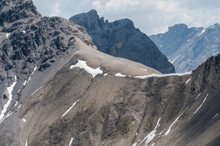
Aufstieg: Schneereste. Abstieg nach Livigno: bitte konsultieren Sie https://www.livigno.eu/ oder +39 0342 977800
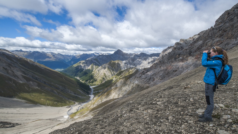
Excellent opportunities to observe ibex.
Particularities
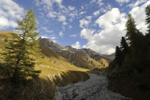
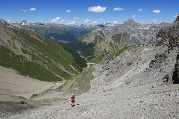
Ibex sightings, wonderful view of the Trupchun valley and into Italy (Val Saliente); possible to make a round trip via Livigno.
Follow-up hikes
Return to the starting point Alp Trupchun and back on Route 01.
Alternatively there is the interesting continuation to Livigno (Fuorcla Trupchun - Livigno: 2.30 h). Return from Livigno to Zernez is possible by bus, see sbb.ch.
Difficulty: white-red-white / medium T3 (*)
Steep and strenuous, slippery scree in the upper part, surefootedness required, especially on the descent to Livigno.
(*) Grading system SAC
Arrival
See Route 01 (incl. hike to the starting point Alp Trupchun)
Season
June, July, August, September, OctoberRoute-information
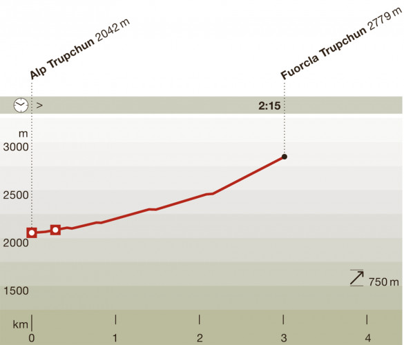
- Length
- 3.00 km
- Vertical heigth
- 750 m
- Time required
- 2 hours 15 minutes
- Level technique
- Middle
- Level condition
- Middle
Arrival
- Starting point
- Alp Trupchun. Anreise siehe Route 01 (Altitude: 2042 m)
- Destination
- Fuorcla Trupchun (Altitude: 2779 m)
Infrastructure
- Picnicplace
The offer is suitable for
- Adults
- Children from 7-12 years
- Children >12 years
- 50+
- Families
- Groups
Contact
NationalparkzentrumUrtatsch 2
7530 Zernez
Tel. +41 (0)81 851 41 41
Mobile -
www.nationalparkzentrum.ch